Blockage severity82/100
Visible obstruction may retain and mobilize street waste during rainfall.
40% weight · 32.8 pointsDrainGuard turns visible street evidence and changing conditions into explainable inspection priorities—then verifies whether cleanup worked.
A decision has to be made.
DrainGuard intervenes through Detect → Prioritize → Priority Shock → Allocate → Verify → Close.
The model runs on the image, then a transparent risk formula combines obstruction, litter, and rainfall. No black-box flood claims.
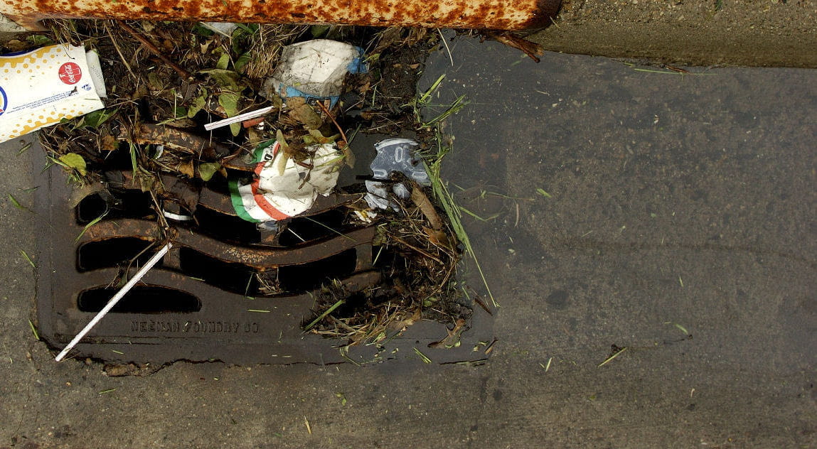
Choose a photo — analysis starts automatically.
Visible obstruction may retain and mobilize street waste during rainfall.
40% weight · 32.8 pointsUses 18.0 mm as the current or selected scenario input.
30% weight · 8.4 pointsVisible waste increases potential environmental concern; it does not measure pollution volume.
20% weight · 12.4 pointsHigh proximity concern: mapped water feature about 180 m away.
10% weight · 10.0 pointsRecommended action: Schedule inspection and cleanup within 24 hours.
Environmental decision-support estimate. This helps prioritize inspection using visible blockage, litter evidence, rainfall conditions, and mapped environmental context. It is not a hydrological model or a prediction of pollution volume.
Change the rainfall scenario and watch the existing scoring logic update priority, environmental concern, and the ranked queue. This is scenario exploration for decision support—not a weather forecast or flood prediction.
Severe visible obstruction remains the strongest priority contributor.
Visible evidence remains lower than the reports above it.
Visible evidence remains lower than the reports above it.
Cleanup already verified; this report remains visible for routine monitoring.
Scenario exploration for decision support. These are controlled inputs, not a weather forecast or a prediction of flooding or pollution volume.
Calculated only from reports added on this device. Demo scenarios are excluded.
Add a location after inspecting a photo, or select Demo preview to see how the dashboard responds.
Select a controlled scenario to update the inspection, scoring, explanation, and map workflow. These examples are not real municipal observations.
Crews see cleanup priority, environmental concern, evidence status, and the recommended action—not simply the newest report.
Reports, scores, and compressed before/after evidence survive refreshes on this inspection device. Shared multi-user storage requires a connected municipal database.
Dispatch now. Cleanup priority 84/100 · environmental concern 87/100.
Low-confidence or non-drain evidence requires a field officer to check the inlet.
Transparent capacity allocation—not route optimization. DrainGuard selects the highest-priority dispatchable reports using the current scenario and distributes them across available crews. Human-review cases stay with the review queue.
All open reports fit within today's capacity.
Detection is not the finish line. Verified action is.
After the crew cleans this drain, upload a second photo. The AI compares obstruction and litter with the original evidence before closing the report.
Detection alone does not prove the problem was solved. DrainGuard verifies the cleanup evidence.
Before · 82% blockedAfter photo appears here
A research-backed ResNet-50 classifies blockage locally in the browser. A drain-domain gate rejects uncertain photos; COCO-SSD is used only for visible litter.
Central configuration drives cleanup priority and a separate environmental decision-support estimate. Missing waterway context lowers coverage instead of becoming a fake value.
The system ranks inspections and turns limited capacity into a concise, traceable field plan for cleanup teams.
A normalized scene fingerprint must match the original drain before blockage reduction can close the task. Uncertain pairs go to human review.
Balanced blocked-versus-clear audit using the four cameras held out by the source research.
| Actual | Predicted blocked | Predicted clear |
|---|---|---|
| Blocked | 20 TP | 0 FN |
| Clear | 3 FP | 17 TN |
Threshold fixed on 28 images from seven different cameras, then tested once on 40 balanced images from four source-paper test cameras.
95% accuracy interval: 80.1–97.4%Open dataset + research weights ↗Scope: this is a reproducible proxy audit on UK trash-screen imagery, not claimed Bengaluru street-drain accuracy and not flood prediction. Uncertain field images still go to human review.
| Controlled test group | Cases | Expected behavior | Decision |
|---|---|---|---|
| Blocked drain controls | 3 | Remain open and ranked | 3/3 pass |
| Clear drain controls | 3 | Low obstruction signal | 3/3 pass |
| Same-drain cleaned pairs | 2 | Match scene, then verify reduction | 2/2 pass |
| Unchanged after evidence | 1 | Reject zero-point reduction | 1/1 pass |
| Different-scene after photos | 2 | Reject scene mismatch | 2/2 pass |
| Non-drain input | 1 | Route to human review | 1/1 pass |
Twelve deterministic checks cover ranking, clear evidence, unchanged cleanup, wrong-scene evidence, and non-drain review routing. These verify workflow policy separately from the model audit above.
Every priority exposes the blockage, litter, rainfall, and context evidence contributing to it.
Unavailable map or weather context lowers coverage instead of becoming a fabricated value.
Low-confidence images, mismatched scenes, and uncertain cleanup evidence route to review.
Passing workflow tests demonstrates deterministic product behavior. It does not establish scientific validity or field-model accuracy.
DrainGuard supports inspection prioritization. It does not predict floods, measure pollution volume, or replace hydrological and engineering assessment. Scores depend on image quality, rainfall inputs, and available map context.
Prototype v0.15 · Field pilot